

We at Eastbourne Eco Action Network are helping the town become carbon neutral by 2030, which means working with communities, businesses and the local councils on the many environmental challenges we face. One of the things we can do is bring people together and give people the chance to tell their stories and discuss openly the most effective ways to take action.
Two years ago, we organised the Sustainable Business & Solar Summit next door at the Welcome Building – and one of the key questions we wanted to ask was: we live in officially the sunniest town in the UK – so why is there so little solar energy generation? Particularly on the large flat roofs of the industrial and retail units – and the enormous car parks that surround them.
Last year we convened the Sustainable Transport & Active Travel Summit at the Welcome Building, which also brought together lots of experts and brilliant people. The leading question I wanted to ask was why Eastbourne is practically the only seaside town in the country without a safe, traffic-free way of riding a bicycle or scooter along the seafront. I’m not sure if we have the answer to that – but at least we publicly asked the question! Fast forward to this year – and the theme of the conference is sustainable food production and distribution in the local area – brilliantly organised by the Eastbourne Food Partnership. I’m not sure if they have a key question to frame the theme this year – but can I suggest one: how is it that the sunniest town in the UK can also seem to be one of the wettest?

And it’s the impact of a changing climate on local food production – growing – that I’m going to talk about today. We’re currently working on a project with Blue Heart, which is looking at innovative ways to predict and mitigate the impact of flooding in Eastbourne and southern Wealden for the benefit of local people, businesses and the environment.
Learning about the real experiences of growing is the heart of our project – as such we have developed a survey that’ll go out to everyone involved in the Eastbourne Food Partnership in the next few days.
So the theme is change. But perhaps I should start with something that hasn’t changed very much at all: the rock and soil that lies beneath us. This is one of William Smith’s famous – and beautiful – geological maps of Sussex, from 1819. It shows the green of the chalk South Downs that of
course meets the sea at Beachy Head. The light blue is Wealden clay, and the greyish bit in the middle is Hastings Greensand – which is often more substantial than the word sand suggests and forms the blocks from which St Mary’s Church in Old Town is made.

The open, treeless downland was created thousands of years ago by Neolithic farmers, who built imposing, fortified villages on hilltops. Much of the East Sussex downs continued to be farmed and grazed through the Iron age and Roman times. The great forests of the Weald were sometimes cleared for hunting estates in the Saxon period that would have included livestock and crops. The Sussex iron industry was built on the iron-bearing clays and sandstones that were scorched in blast furnaces fuelled by charcoal made from the surrounding woodland.

And of course, the different underlying rocks and clays and their varying character and chemical composition had implications for what could be grown where – and the growing community here will be far more knowledgeable about that than I am. But, as George Monbiot points out in his brilliant book Regenesis, much about soil does remain mysterious:
“Soil is this thin cushion between rock and air on which the entirety of human society and civilization is built. 99% of our calories come from it. It’s an extraordinarily complex ecosystem.
It’s more than that – it’s a biological structure, like a coral reef. It’s built by the organisms that inhabit it. If it weren’t for those organisms, there would be no soil. But it’s also got properties, unlike any other ecosystem or biological structure that we know.
In fact, there’s quite a heated debate among some soil scientists as to what soil even is. It’s got some characteristics which make it seem almost like a super organism, in that they get these extra-ordinary synchronized events taking place right across the soil. It is incredible that this system upon which we totally depend is almost unknown to us.”
Eastbourne remained an area of small rural settlements until the 19th century. Four hamlets occupied the site of the modern town. By the middle of the 1800s most of the area had fallen into the hands of two landowning families: the Gilberts (who had inherited land from the Gildredge family) and the Cavendish family. William Cavendish, the Duke of Devonshire, hired Henry Currey in 1859 to prepare plans for an entirely new resort town – and the rest is history.
Perhaps slightly less well known, is the story of Mary Ann Gilbert. Born in Lewes in 1776, she had a relatively poor childhood after her father died. In 1814 she inherited swathes of land and property in Sussex from her uncle. She was married to Davies Giddy, who took on the Gilbert name: they lived at Gildredge Manor and had eight children together.

Shocked by the extent of hardship and poverty in Sussex in the 1820s, which led to the Swing Riots, Mary Ann set up a scheme to cultivate land at Whitbread Hollow, beyond Meads and on the way to Beachy Head, which is now a sports field belonging to Bede’s School. She hired 27 labourers to shift fertile clays from nearby marshland and transport it to the allotment site – and remove flints and pebbles. They managed to produce a healthy crop of potatoes.
By 1832 Mary Ann had nearly 200 people renting allotments, growing mangelwurzels, turnips and potatoes and the occasional pig. She kept detailed reports and calculations and encouraged good practice such as using seaweed as fertilizer and introducing water butts. The number of allotment holders had doubled to over 400 by 1844. She also founded agricultural schools at Willingdon and East Dean that were staffed by teachers from the local workhouse.
Mary Ann Gilbert’s experiment reduced poverty in Sussex by almost half. It was an agricultural revolution that was the foundation of the allotments we see across the country. I think you’ll agree, it’s a really inspiring story of a local woman and one I didn’t know until very recently – I must thank Sally Lee from Rooted Community Food for enlightening me – it’s a shame she can’t be here today.
Mary Ann Gilbert died in 1845, but her legacy is still felt. Eastbourne Allotments & Garden Society, has overseen the town’s 14 allotment sites for many years. The society currently rent out over 1,200 plots, all of which are in high demand, with hundreds of people on a three-year waiting list for a plot.

Could it be that allotments are actually becoming fashionable? I’m beginning to think so. And why not? We seem to be in an age of anxiety – be it technology overload or concerns about pollution or the reliability of exports and imports from neighbouring countries. And this seems to be a time when lots of people want high quality, healthy, affordable local fruit and veg – plus social contact with like-minded people, exercise and a general warm glow and sense of wellbeing. That’s certainly what I’ve picked up from my visits to the Gather and Rooted community gardens. They’ve kindly agreed to fill in our survey about growing in a changing climate – and hopefully many of the other local growers will too.

We will analyse the results and report back in a few weeks’ time. Perhaps not surprisingly, given the very wet weather over the last couple of years – rainfall around 30% above average this year – and the fact that many allotments and gardens are located on the floodplain – the feedback so far has centred on designing ways of improving drainage on plots. French drains and wicking beds have been mentioned, along with more water butts and ponds.
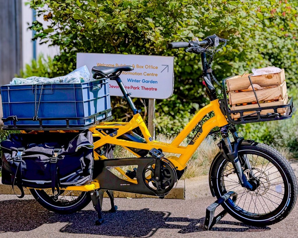
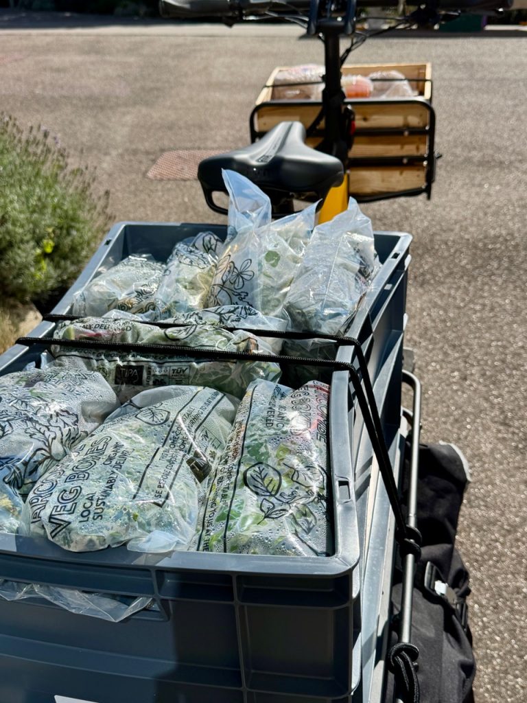
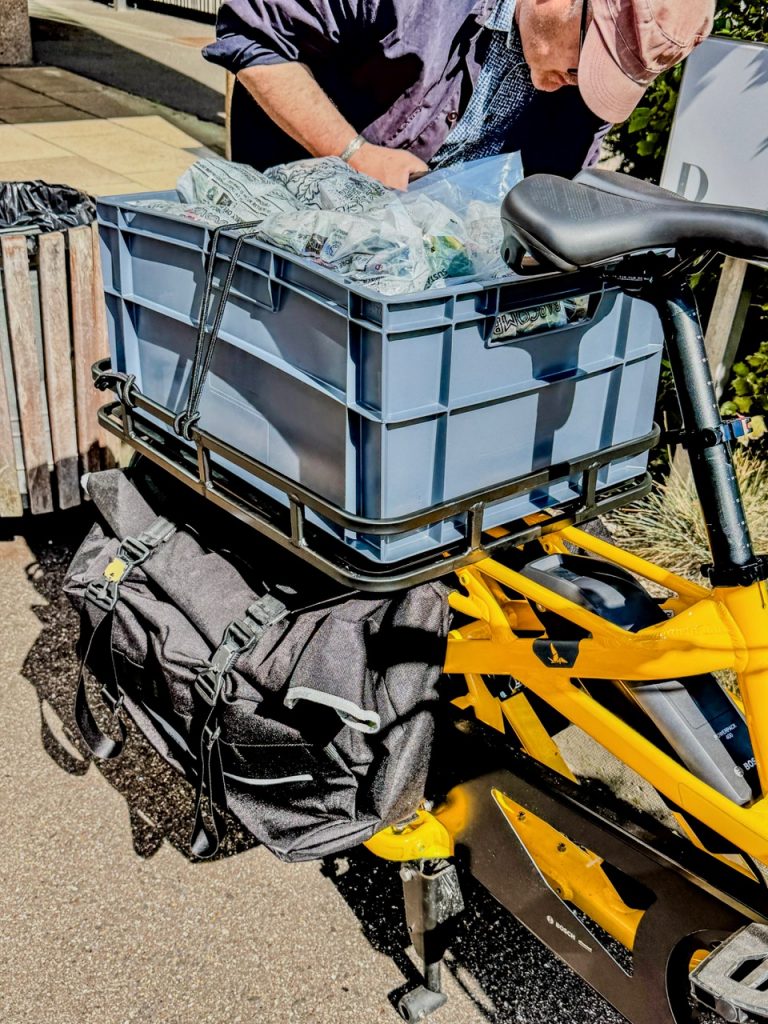
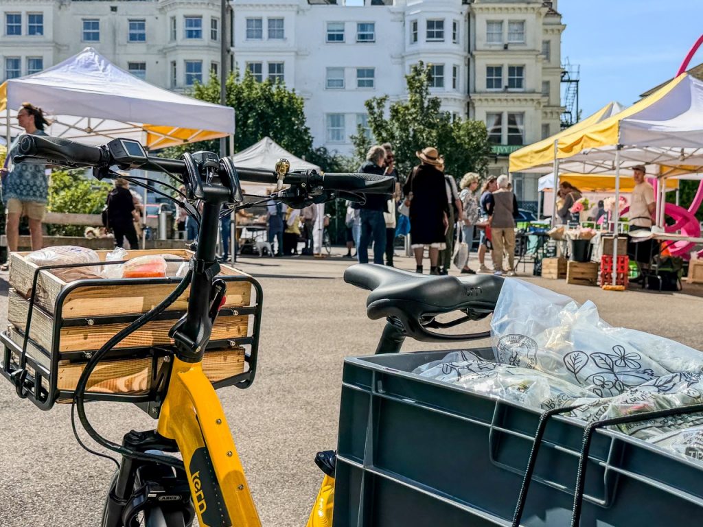
In recent weeks we’ve been talking about fundraising for a community cargo bike that can help with deliveries to community fridges, food banks and retailers. We might be better off with a community cargo boat!

A video of Robert McGowan’s presentation at the Eastbourne Food Summit is available here:
https://youtu.be/XuAlNry3k-w?si=Zgl4k51JTGrDRXcg
 Some of us from the Eastbourne Eco Action Network team paid a visit to the Gather Community Garden at the Churchdale allotments in Eastbourne recently and had a chat with the team there about how they deal with some of the impacts of climate change on their site. The community garden is well-managed with a large team of volunteers busily looking after a wide variety of food crops, with much of the surplus distributed to foodbanks and community fridges across the town, helping to alleviate food insecurity locally through a steady supply of fresh, organic, nutritious fruit and vegetables.
What emerged from the chat was that the garden experiences growing problems from both the stronger winds and more intense rainfall events that climate change is bringing to the local area. The winds can now be so strong that the roofs of various wooden structures around the site may be blown off at times, or the structures themselves might be blown over, resulting in much maintenance work to repair and reinforce those structures. The wind effect is most pronounced on the side of the site most exposed to the wind because of a lack of trees on that side, but the opposite side of the site is bounded by a line of very tall trees, providing good wind protection on that side.

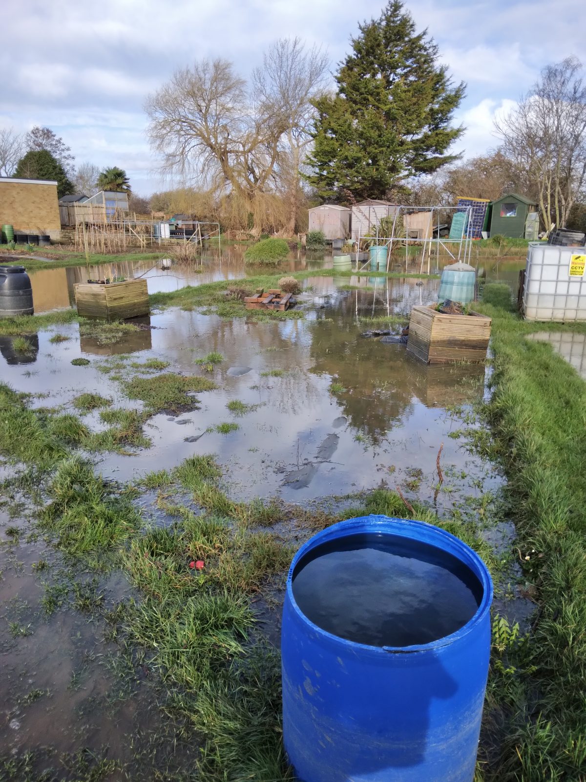
More significantly, the site experiences severe flooding at times, especially as the site is very much in the Eastbourne Levels, a low-lying area of town almost at sea-level and therefore difficult to drain fast enough during periods of intense rainfall. The solution that the garden is seeking is the insertion of a French drain alongside one side of the site, then linking that drain to a drainage ditch (the Horsey Sewer) just outside the entrance to the site. This ditch is part of a vast network of drainage ditches that help to drain the Eastbourne and Pevensey levels, which receive a huge volume of water from the many rivers and streams flowing into them throughout the water catchment area. Indeed, without this drainage network, the Eastbourne Levels would revert to becoming the marshland it once was centuries ago.

According to Wikipedia, “A French drain (also known by other names including trench drain, blind drain, rubble drain, and rock drain) is a trench filled with gravel or rock, or both, with or without a perforated pipe that redirects surface water and groundwater away from an area. The perforated pipe is called a weeping tile (also called a drain tile or perimeter tile). When the pipe is draining, it “weeps”, or exudes liquids. It was named during a time period when drainpipes were made from terracotta tiles. French drains are primarily used to prevent ground and surface water from penetrating or damaging building foundations and as an alternative to open ditches or storm sewers for streets and highways. Alternatively, French drains may be used to distribute water, such as a septic drain field at the outlet of a typical septic tank sewage treatment system. French drains are also used behind retaining walls to relieve ground water pressure”.
But the garden is waiting for permission from the Environment Agency for permission to connect the French drain to the drainage network, as the agency has the ultimate responsibility for the network and controls the water quality as well as maintaining the many pumps and sluice gates that regulate the flow of water through the network. This permission is essential before work on installing the drain can begin (assuming sufficient funds can be raised for this project).
Whilst we were at the garden, we talked to a volunteer about his work and discovered that one of the problems the site experiences in very hot summers is the soil drying out and becoming very hard, making it difficult to break up when preparing a new growing bed. There is plenty of mains water on site so watering the rowing beds is not an issue (apart from the labour involved!), so there is not an emphasis on having lots of rainwater butts on site like we saw on other sites like the forest garden in Pevensey, which lacks mains water. However, the volunteer did report that he would like to see a large water container sunk into the ground on site to store water so as to reduce the amount of walking from the mains water pipes outside site to the growing beds.
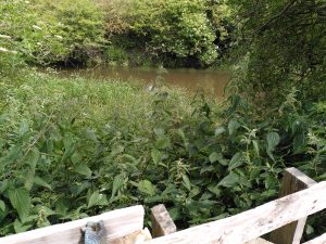
Pevensey Bay is a low-lying coastal community in East Sussex, next-door to the large resort town of Eastbourne. The shingle bank along Pevensey Bay’s seafront provides protection from the strong storm surges that often come its way, especially in winter. But the village also experiences flooding inland, as several drainage channels run through it, helping to drain the large water catchment area known as the Pevensey Levels, a freshwater wetland renowned for its wildlife. Because the village is more or less at the level of the high-water mark, the water in the drainage channels can sometimes only be released out to sea when the ebb tide falls below the level of the water in those channels, which can be very full in periods of intense rainfall, periods which will become ever more frequent and intense as anthropogenic climate change accelerates. This can lead to the channels overflowing their banks at times.

To explore this phenomenon further, following on from my previous investigation on climate change impacts on local food growing, in collaboration with the Eastbourne Food Partnership, I paid a visit in June 2024 to some allotments at Pevensey Bay owned by Pevensey Parish Council, situated off Waverley Gardens. These allotments are next to the Salt Haven, one of the main drainage channels running through the village, and therefore had a history of flooding incidents. From my conversations with some of the allotment holders on site, it was clear that many of the allotments there are flooded at least once every year, but that the winter of 2023-24 was the worst in living memory for flooding, as there were about 4 or 5 very severe flooding incidents. Not all the site gets flooded, as about half the allotments are on higher ground as much of the site slopes gently upwards from the Salt Haven. But all those allotments that back directly onto the haven do flood every year.

The main impact of the flooding is that growing vegetables is pretty much impossible in winter on the areas that do flood, but it was noticeable that there were many large, mature fruit trees and bushes on the areas that experienced flooding every year, and that they seemed to be flourishing, with plenty of fruit developing on them, which seemed to indicate a high degree of tolerance to the flooding than if vegetables were planted, perhaps indicating how the allotment holders had adapted to such flooding by earmarking those areas just for fruit growing. Certainly the allotment holders I spoke to were phlegmatic about the flooding situation, accepted that only fruit trees were capable of surviving the flooding and just planned most of their vegetable growing higher up on the slope above the flooding level. But they reported that because there had been so much rain over the previous winter, the whole site was so waterlogged that most vegetable planting had to be significantly delayed until May, shortening the growing season quite considerably. The difficulties for growers on the site is reflected in the fact that the rental charges for the allotments are much lower than on other allotments in the area, especially in Eastbourne. However, it was clear from my site visit that, once planting had finally got under way, the productivity of the site appeared to be high, with most allotment plots demonstrating a healthy abundance and growth of crops.

One allotment holder was keen to show me a drainage pipe outlet that was below the haven bank as it apparently aids the flooding of the site by allowing the water to flow easily onto the site well before the haven breaks it banks, leading to a much more rapid and more frequent flooding of the site than perhaps should be the case. It appears that there is no tide flap (or the tide flap is damaged or malfunctioning) on the haven side of the pipe to shut off the flow when the water level in the haven rises above the level of the pipe. I heard that there are probably several other similar pipes on site within the bank undergrowth with the same or similar issues, which has been raised by some allotment holders with the local Environment Agency staff to no avail apparently.
It does raise the possibility of whether a survey could be done at some point (perhaps by the Blue Heart Project or an organisation funded by it?) to investigate what kind of pipe drainage does actually exist along the Salt Haven and how it affects water levels both within the haven and beyond its banks. Such a survey would presumably involve extensive clearing of the undergrowth along the bank to check where the pipes are and what condition they are in. But it would perhaps generate valuable data about how the haven actually functions in a critical stretch of it before it reaches the sea, and also create more accurate data about how fluvial flooding impacts Pevensey Bay generally, as many of the gardens elsewhere in the village also experience flooding from the drainage channels.